Nemy Banthia, a professor of civil engineering at the University of British Columbia (UBC), and his doctoral student Mohammed Farooq have developed a sensor network that can detect the early stages of mudslides and bridge foundation failures that are caused by flooding.
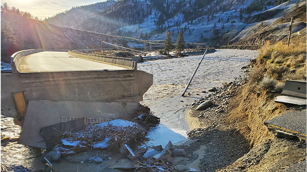
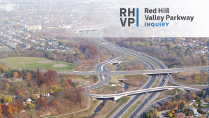
What happens when rushing water assaults a bridge is not an academic question, as British Columbians found out recently.
Torrential rain in November 2021 and the resulting floods damaged many bridges and caused one, at Merritt in B.C.’s interior to collapse.
“Flooding causes foundation loss due to persistent, large-volume and high-velocity flows of water that bridge foundations are not designed for,” said Banthia. “Once the foundation has been lost, collapse of the bridge is inevitable.”
This is how the UBC-developed system works.
An array of dielectric sensor, also called capacitance sensors, are placed at the foundation of bridges where the impact of flooding is most severe.
The sensors monitor the underwater condition of the foundations by detecting changes in their electromagnetic properties.
They also provide early indication of any erosion of stable, compacted soil around the foundations and the build-up of any loose, unstable soil that has been caused by flooding.
The data captured by the sensors is transmitted wirelessly by low-power, low-cost microcontrollers to the cloud for analysis and visualization.
All parts of the system are off-the-shelf. What’s proprietary is the analytics that were developed by Banthia and Farooq.
“A real-time monitoring system can greatly reduce the loss of life by getting early warning of an impending failure,” said Banthia. “It can also quickly identify any infrastructure that has been damaged by flooding and help to optimize the use of resources for the rehabilitation of damaged structures.”
Banthia said the sensor networks have already been proven to work.
They detected the erosion of supporting sediments near bridge piers and abutments at an over-water platform on Guichon Creek, which flows through the campus of the BC Institute of Technology in Burnaby.
And, once the COVID-19 pandemic has ended, a proof-of-concept network will monitor a site at the Seven Sisters hydroelectric generating station on the Winnipeg River, 60 miles northeast of the Manitoba capital.
Banthia said a sensor network could be “pricey” to maintain, “though likely a fraction of the cost of inaction.”
He estimates it would take roughly 20 sensors, a micro-controller and a power source to monitor a bridge, for a total cost of just under $1,000, plus $5 per month for a SIM (subscriber identification module) card to beam data to the cloud.
“Once installed, the sensors should last 25 years before they need to be replaced,” he said.
Banthia and his research team have plans to make use of predictive analytics and artificial intelligence as soon as they can.
“But to do that requires more data than we have now,” he said.
Banthia said he hopes to form partnerships with industry and bridge maintenance authorities and to commercialize the technology in Canada and other countries.
“Although the sensor systems are designed to detect bridge foundation failures, they work equally well for assessing and catching early signs of flooding damage to dams, pipelines and roadways,” said Banthia.
There could be a big demand in the future for Banthia’s sensor networks if a University of Western Ontario engineering professor’s climate predictions for Canada pan out.
Slobodan Simonovic has developed a set of maps that show how floodplains in Canada, such as the low-lying areas in which parts of major cities like Vancouver and Montreal are located, might go underwater some time in the next 80 years, thanks to climate change.
According to Simonovic’s maps, about four million Canadians – a little more than one in 10 of us – live in areas that are already susceptible to flooding. That means they could be in even greater danger in the future.
The maps are a visual representation of almost 150,000 climatic reference documents, such as past and present historical rainfall and snowmelt run-off data; topographic analyses; hydrodynamic modelling; urbanization and deforestation factors that impede effective drainage; and a range of climate projections.
Using this data, Simonovic has superimposed on web-based maps his estimates of the frequency of future floods, flood depths and flow velocity.
Anyone interested can search by postal code and zero in on particular neighbourhoods or examine individual watersheds and flood zones under various climate-change scenarios.
The map is available here.


Recent Comments
comments for this post are closed