Roadbuilding tenders for access roads into and around the Site C project are starting to trickle out with more expected this summer. More information is expected this month when contracts for realigning a possible six portions of Highway 29, totaling 30 kilometres and four bridges, will be announced.
"We will have more information in a couple of weeks," said Ministry of Transportation and Infrastructure (MOTI) spokesperson Sonia Lowe.
The ministry is handling the contracts for BC Hydro.
This includes the contract for the Highway 29 realignment, which is needed as portions of the highway running along the Peace River will be flooded or affected by erosion.
A BC Hydro financial document authored by Site C’s chief financial officer Thomas Assimes in March 2015 outlines a procurement schedule for the highway.
It also sets the date for the Requests for Qualifications in 2016.
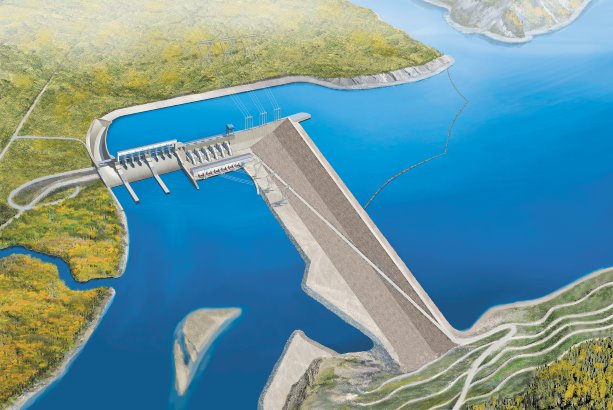
The Site C dam project is located eight kilometres outside Fort St. John.
The Alaska Highway (Highway 97) runs north-south past the town and connects into Highway 29 by Charlie Lake.
The road work for the Site C project is divided into three parts:
One part is the Highway 29 realignment.
There is also the temporary access or work roads, in or around the BC Hydro dam site.
These will be partially decommissioned with the remaining routes becoming private service roads.
Lastly, there is the upgrading of existing public rural residential roads off Highway 97 running through Fort St. John or the regional district area that connect to the existing private BC Hydro road into the site.
The existing private BC Hydro access road into the construction site was created in the early 1970s, when Site C was first considered.
Gated entry is near the Fort St. John landfill at the edge of town.
The road work awarded so far has focused upon work at the site, but this summer’s contracts will see the upgrading of existing rural residential roads to connect to BC Hydro’s private entry road.
"Several local area roads will have improvements made to accommodate additional truck traffic," said BC Hydro community relations liaison Dave Conway.
Local roads needing improvements include the 240, 269, 271 and the Old Fort roads.
BC Hydro had done geological work on the roads in 2013 for the expected widening.
Many roads need an extra 1.5 paved metres of shoulder to increase safety.
Conway said that 240 Road will also require paving.
"The first tender for public road improvements is expected to be issued this summer," he said.
The BC Hydro private road from the landfill area to the site is also being upgraded, but that work is part of the North Bank clearing contract.
Requests for Proposals have gone out, but a contractor hasn’t been chosen yet.
The deadline was in March.
The North Bank work at the site includes excavation and disposal of three million cubic meters of material, quarry development – including riprap production of about 100,000 cubic metres, building 7.25 kilometres of access road, as well as the clearing and grubbing of 115 hectares.
The South Bank clearing contract has been awarded to Chetwyn-based Paul Paquette and Son’s Contracting Ltd.
It includes removal of 620 hectares of trees and vegetation, construction of up to 30 kilometres of temporary access roads and associated landings, upgrading and maintaining an existing access road (to an existing oil and gas loading area), collection and disposal of waste material and site preparation for bridge construction.
Conway said most of the temporary 30 kilometre roads on the South Bank will be decommissioned after the dam construction work has finished.
The MOTI’s contracts on Highway 29, which connects Hudson’s Hope to Fort St. John, will see realignment work on four to six stretches of the highway which runs along the Peace River between the existing Peace Canyon Dam and the new Site C Dam.
That section of the Peace River, once the new dam is constructed, will act as a reservoir between the two dams and increased water levels will flood sections of the existing highway.
The sections of the highway that need to be moved because of flooding include Lynx Creek (eight kilometres), Farrell Creek (two kilometres), Halfway River (four kilometres), and Bear Flat/Cache Creek (8.5 kilometres).
In addition, the erosion from the raised river is expected to compromise two other stretches of roadway.
They are Dry Creek (1.5 kilometres) and Farrell Creek East (up to six kilometres).
These areas may be realigned as well.
The North Bank construction work is expected to begin in summer 2015, Conway said.

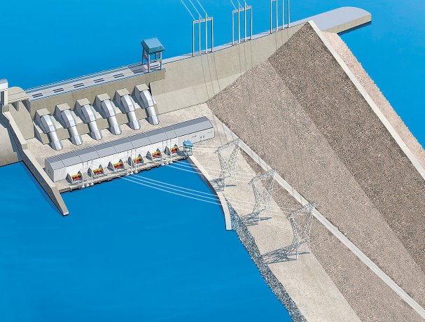
Early road work contracts related to the construction of the Site C Dam have started to be issued.
Photo: BC Hydro"


Recent Comments
comments for this post are closed