An elaborate system of sensors and seismic instruments is working quietly in the shadows in British Columbia to constantly monitor the effects of the 100 or so earthquakes a day on critical infrastructure.
The Smart Infrastructure Monitoring System, dubbed BC SIMS, records any tremors and reports information to Ministry of Transportation and Infrastructure (MOTI) engineers to help them keep B.C. safe.
“It’s one of the tools we use for situational awareness,” explains Alireza Ahmadnia, senior seismic and structural health engineer at MOTI. “Our goal is to provide safe, reliable transportation to every British Columbian and BC SIMS helps us to have more understanding of the behaviours of structures after an earthquake.”
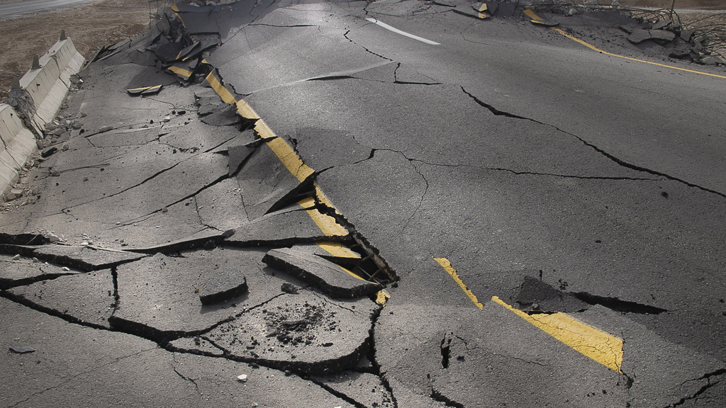
B.C. gets a lot of earthquakes because it is a highly seismic region. Most of the tremors are small and do not cause any damage to infrastructure. While the province hasn’t seen a major quake in many years, Ahmadnia notes scientists have indicated B.C. is due for a big one so the province must be prepared.
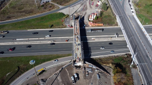
BC SIMS is an important part of the MOTI’s seismic engineering toolkit. The system is actually made up of two unique parts – the Strong Ground Motion Network (SGMN) and the Structural Health Monitoring (SHM) system.
As part of the SHM system, seismic instruments like accelerometers and displacement transducers have been installed on infrastructure such as bridges along lifeline routes in B.C. to monitor vibrations. The type and number of sensors are different at each location. The sensors are remotely accessible via the Internet and continuously stream real-time structural vibration information to the BC SIMS remote data centre for analysis.
The objective is to provide the MOTI with information immediately following a significant event such as strong earthquake or wind. The SHM system currently covers 14 bridges and one tunnel but is expected to increase in the upcoming years.
“If there is an earthquake, those sensors can pick up the response of the structures and we can then go and do some analogies and we will understand the status of the structures and if there is damage, and the location of the damage,” says Ahmadnia. “That information will be complementary to other inspections. It gives you another layer of information that you can use to understand the behaviour of the structure after an earthquake.”
The SGMN, meanwhile, is a network of approximately 160 sensors installed at various public schools, government offices, fire halls and ambulance stations across the province. The network monitors and records seismic activities in real-time. When an earthquake occurs, the sensors immediately report the level of shaking to the BC SIMS data centre.
A shake-map and an earthquake report are automatically generated following the earthquake. A shake-map is an interactive colour-coded map that shows the estimated level of shaking across the earthquake-affected region.
The earthquake report provides additional information about the earthquake such as date and time, location, depth and magnitude, along with a list of infrastructure in the area that could be affected. The report identifies the estimated level of shaking at the location of bridges, schools and tunnels. It is also posted on the BC SIMS webpage.
An automated service sends out immediate earthquake notifications by email to registered users of the BC SIMS network.
“When an earthquake happens, those sensors pick up shaking and then they report those findings to a data centre, and if the shaking level is high, then BC SIMS will understand that and sends an alert and notification and produces a report,” says Ahmadnia.
The report and maps are used by ministry engineers to compare the earthquake event with the seismic threshold that structures such as bridges and tunnels are designed to withstand.
Using the information helps engineers and emergency managers determine where the strongest motion occurred so they can identify which sites are a priority and focus their resources.
The first thing the MOTI is concerned about is creating awareness if there is an intense shaking situation and showing which structures could be affected, explains Ahmadnia.
“If we are looking at the map, we know that, for example, the area where we have to send first responders.”
If an earthquake event is greater than six on the Richter Scale, an email will be sent to all ministry staff asking them to confirm their location, job title and availability for work. This information will be used to make strategic decisions and deploy staff for response.
Ahmadnia says the system alerts the MOTI to potential problems and enables them to quickly put together a post-earthquake damage-assessment plan.
The ministry has a set of protocols and step-by-step procedure that inspectors follow when they visit a site to look for possible damage to infrastructure, says Ahmadnia.
“When they arrive at a bridge, for example, it identifies what components they should take a look at and how they can rate the safety of the structure.”
Inspectors can use a mobile app to collect relevant information that can be sent digitally via satellite or radio or phone to an emergency response centre so they can see the status of damage and make an assessment.


Recent Comments
comments for this post are closed