Skip to Content
View site list

Profile

Pre-Bid Projects

Pre-Bid Projects

Click here to see Canada's most comprehensive listing of projects in conceptual and planning stages

Infrastructure

75 years: Newly digitized photos show extent of historic Winnipeg flood

75 years: Newly digitized photos show extent of historic Winnipeg flood
DAVID PORTIGAL/CITY OF WINNIPEG ARCHIVES — Workers use heavy machinery to build a dike near the subway on south Main Street, just north of the Norwood Bridge.

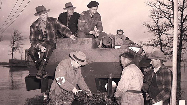
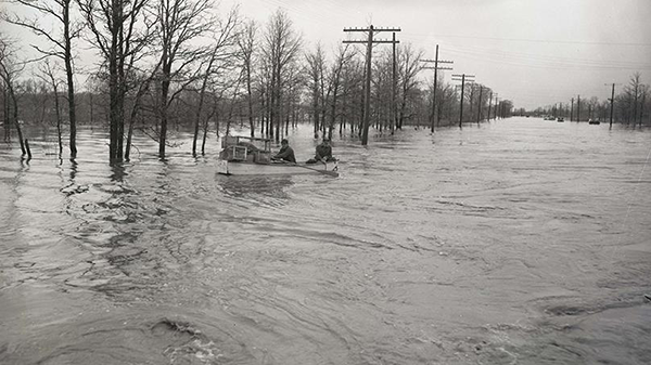
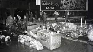
WINNIPEG — It’s been 75 years since one of the worst floods in the city of Winnipeg’s history.

At the time around 100,000 residents were evacuated. The 1950 flood was one of the largest evacuations for its time in Canadian history, reports the city.

To mark the historic flooding, the City of Winnipeg has digitized nearly 200 photos. The images provide a glimpse of the massive relief effort that took place when the Red River spilled its banks.


Relief workers attempt to remove a submerged fence caught in the propeller of a Muskrat amphibious vehicle during the flood.
DAVID PORTIGAL/CITY OF WINNIPEG ARCHIVES — Relief workers attempt to remove a submerged fence caught in the propeller of a Muskrat amphibious vehicle during the flood.


“Given the flood’s anniversary, it was important for us to make these records easily available,” said Jarad Buckwold, digital archivist with the archives and records control branch.

The photos were taken by David Portigal and are from a group of negatives the City of Winnipeg Archives had received.


DAVID PORTIGAL/CITY OF WINNIPEG ARCHIVES — Two men paddle a boat down a heavily flooded St. Mary’s Road near River Road during the 1950 Winnipeg flood.


They’ve been added to the archives’ River City: Records of Flooding in Winnipeg digital exhibit in the Resources and Archival Research section. The exhibit looks at archival records of significant flood events in the city’s history.

Recent Comments

Your comment will appear after review by the site.

You might also like