The Cariboo Wagon Road is often referred to as British Columbia’s first mega-project.
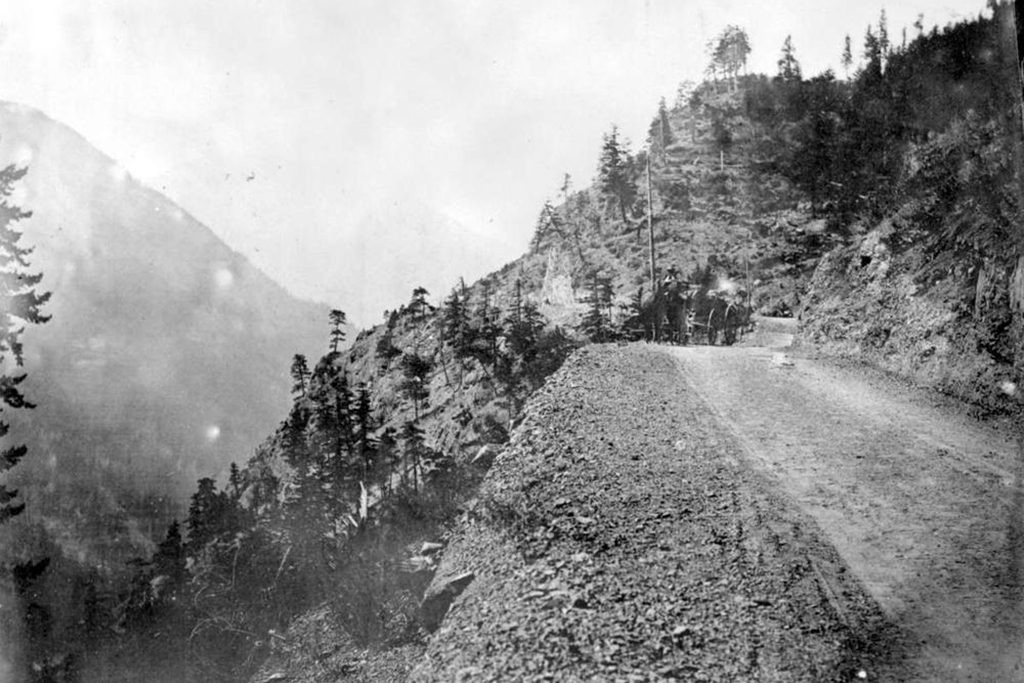
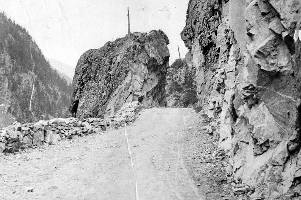
The 650-kilometre road was constructed under direction of the Royal Engineers between 1862 and 1865 from Yale in the south to Bakerville in the north to provide access to gold fields during the Cariboo Gold Rush. Using original survey maps of the Royal Engineers, the New Pathways to Gold Society (NPTGS) is embarking on a construction project that could see much of the road restored as a recreational bicycle and hiking trail.
The Cariboo Wagon Road Restoration Project, a partnership between NPTGS and the District of 100 Mile House, was recently granted $54,550 in funding from the B.C. Rural Dividend Program to rebuild sections of the road, beginning with the 100-km section between Clinton and Lac La Hache.
James Douglas, first governor of the colony of British Columbia, initially requested a military presence to keep foreign gold seekers at bay during the Cariboo Gold Rush. The request was refused.
“Instead they sent the Royal Engineers to assist the colony,” says Dan Marshall, adjunct assistant history professor at the University of Victoria and author of Claiming the Land: British Columbia and the Making of a New El Dorado. “They created early surveys to lay out town sites such as New Westminster, Yale, Hope, Lytton and Lillooet. But roadbuilding became the priority of the new colony, because for a gold rush to succeed, you needed to have good transportation to provision these remote mines effectively.”
There was good reason to encourage miners to use a newly built road. The colony sold mining licenses, which ensured that revenue would remain in British Columbia. Having access to good roads would discourage miners from using backtrails and river routes to avoid license fees. It would also encourage miners to settle where they established claims, keeping gold wealth inside the colony.
Marshall also notes that England was eager to divest itself of its colonies, provided they were self-sufficient. Building roads was part of the qualification for independence.
The Royal Engineers leveraged existing fur trading trails and those routes established by First Nations, surveying new sections to join the segments. The road was built largely by pick, shovel and explosives with work crews that included workers from First Nations and China.
“My great-great-great uncle William worked as a foreman on one of the most difficult sections of the road from Spuzzum to Boston Bar,” says Marshall. “The Cornish people, of which my ancestor was one, were great miners, great builders and very good with black powder. You had to do a lot of blasting and tunneling in the steep sections of the canyon corridor to transform them from footpaths to roads that could accommodate two wagons passing each other.”
Initially essential, the Cariboo Wagon Road eventually fell out of favour as new roads were built and railways surpassed roads as the transportation of choice.
“In some places the canyon corridors are so narrow, the CPR railway essentially runs right down the centre of the Cariboo Wagon Road,” says Marshall.
Other parts of the road were paved over and incorporated into new roads. Some sections are now located on private property while still others remain intact and isolated. In order to establish an accurate route map, researchers accessed Royal Engineers documents housed in the B.C. Surveyor General’s vault.
“This collection includes diaries, ledger books and their beautiful cloth-linen maps, which are more like works of art,” says Marshall.
The current project involves combining the information on those maps with maps from Google Earth and literally walking each section of the road while recording GPS coordinates. That study will determine where road segments remain intact, and what will be required to restore each segment.
“The Cariboo Wagon Road was once called the Eighth Wonder of the World,” says Marshall. “Our ultimate aim today is to open as much of the trail as possible and create a great heritage tourist attraction.”


This such great news for BC’s Historical Trails. After opening up the old railway beds ( Kettle Valley Railroad & Coquihalla etc.) for hiking & bike riding opportunities.