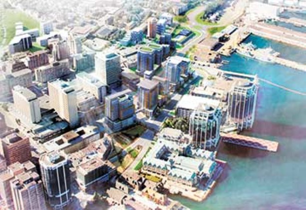
Halifax is moving forward with an ambitious plan to demolish an underutilized highway interchange, in order to redevelop 16 acres of land around the waterfront and transform the downtown core.
“At the moment, council has authorized the plan and street network, which gives shape to the whole eventual redevelopment,” said Peter Bigelow, manager of public lands planning with the Halifax Regional Municipality.
“The key to the success of the project, so far, is that we have taken an integrated approach with engineering, urban design, financial, market assessment and the condition of existing assets. All this drives the phased approach to development, which will allow us to maintain access to downtown, during the demolition.”
Halifax Regional Council approved The Cogswell Lands Plan on May 13, which is the guiding document for the next stage of work for the removal and re-design of the Cogswell Interchange.
The functional road network has been approved and city staff were directed to communicate the plan to the public, adjacent landowners and future developers.
“What’s key here is we are doing the planning to engage the public and the process it would go through,” said Bigelow. “When we developed the plan we did a fair amount of talking to the surrounding land owners, developers and government land owners. We will continue those discussions and involvement. However, we are now having a different set of discussions.”
The next stage in the process is the detailed design, which is a necessary step prior to commencement of demolition and reconstruction.
“Once we set up the project office in the next few months, we will put out several request for proposals (RFPs) for engineering design work, development, financials, economic forecast and urban design. This could be one team or a number of external consultants,” said Bigelow.
“The project office will have city staff, but will work collaboratively with consultants. There will be a small team of dedicated staff, whose only task is to move the project through. Other city staff will work at the office as required.”
Detailed design involves issuing RFPs to retain the necessary expertise for the project. It is vitally important, because it finalizes municipal infrastructure requirements and layout. This consolidates community and infrastructure planning at Cogswell and in adjacent neighbourhoods.
This stage is also necessary to firm up requirements for land acquisitions or disposals for street rights of way and open space. It also defines the final configuration of lots for private development.
“One of the turning points for this project was when council went to form-based code versus a land-based code. Land use regulation is focused on uses that happen on land. With mixed use you are open to a greater range and variety of use,” said Bigelow.
“We are encouraging commercial use on the ground floor, with residential use above. We wanted better building to come out of this. This is more about how a building fits into the neighbourhood and the community.”
According to Bigelow, The Cogswell Lands Plan is not just about the redevelopment of the 16 acres that the interchange is sitting on. It is also about reinvigorating the surrounding neighbourhoods, which are currently not connected to the waterfront, because the interchange is a physical barrier to access.
The Independent Market Assessment has identified a strong market for mixed use multi-family residential with some commercial development. The market uptake, estimated at eight to 13 years, recognizes that development will occur in other parts of the downtown.
“The downtown will be business, entertainment, tourism and residential,” said Bigelow.
“Adding the residential component will ensure the downtown is sustainable and viable, because people will live downtown. Seventy per cent of the development will be residential.”
The Plan will also be a catalyst for development in the immediate surrounding area over the next twenty years. However, as a residential mixed-use development it will not shift the downtown core.
The Cogswell Interchange is a mass of elevated ramps and roads, which was built as part of the Harbour Drive transportation plan in 1971.
It was the first step in a six-lane expressway to run along the waterfront on the peninsula and provide traffic access to the downtown core. It would have been similar to the Gardiner Expressway in Toronto.
However, the citizens of Halifax opposed the plan, because it required the demolition of the historic buildings along the waterfront area.
The plan to build the expressway called Harbour Drive was abruptly cancelled in 1971, which left the completed interchange as an underutilized piece of transportation infrastructure.
The City of Halifax hired Toronto-based A.D. Margison & Associates, a consulting engineering firm, to design the Cogswell Interchange and Harbour Drive.
The Gardiner Expressway was planned by an engineering firm called Margison, Babcock and Associates. This firm dissolved in 1954 and eventually became A.D. Margison & Associates.


Recent Comments
comments for this post are closed