The $1.25 billion Port Lands Flood Protection Project (PLFPP) was never designed to prevent flooding of the Don Valley Parkway during extreme rain events.
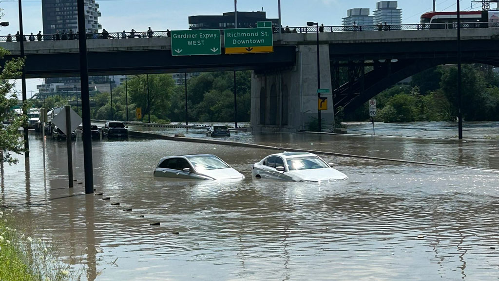
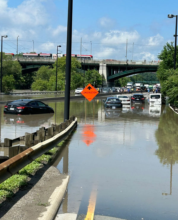
Rains July 15 and 16 saturated Toronto’s core and led to the Don River breaking its banks, leaving dozens of motorists and their vehicles stranded when the DVP roadway became impassable.
David Kusturin, chief project officer with Waterfront Toronto, however, says the PLFPP was always designed to protect the Port Lands, South Riverdale and Leslieville which are further down towards the lakefront on the Don River’s lower reaches.
“The Don Valley Parkway floods and will always flood because it’s on floodplain,” he says. “There’s nothing we can do about that.”
The only way to stop the flooding at that juncture is to remove the DVP, he says, which would be horrendously expensive, or somehow raise it up like the Gardiner which in turn would mean raising the bridges in the area. Both are fraught with engineering and cost challenges, let along political hurdles.
Dredging the Don River deeper creates a ripple effect for dock access during normal water flow and building up the banks on the east side would only force water to the west side, he says because “water will always find a path.”
Dredging will still be required in any event, Kusturin says, but further down.
“We will have to dredge yearly,” he says. “
The focus of the Port Lands project is to mitigate flooding on 700 acres south of Eastern Avenue where 9,000 housing units are planned for the newly created Villiers Island and also making the area more attractive to investors by raising the surface levels while installing beefed up utilities to service businesses and commercial interests.
The plan was always to turn toxic brownfields into viable mixed-use lands, not tackle the issue of flooding further upstream.
To that end the river has been reconfigured to add gentle meanders, a holding tank and more natural flows to the lake, removing the hard turn of the Keating Channel which was engineered 100 years ago and proved problematic since.
Toronto has always experienced floods, he says, and this project was to protect lands that had been ignored for decades and makes them productive again.
The biggest infrastructure project in Toronto’s history kicked off in 2017 and involves 23 separate and individual projects such as new bridges and sealing off the river from toxins leaching from the former industrial lands with an extra layer of charcoal filters.
The design parameters are set to a flow the level of Niagara Falls because it’s known that the Don River can surge during run off to two thirds of the Niagara River.
Work is nearing completion with the last of four “plugs” in the process of being dismantled to allow the waters to flow uninterrupted now containment is no longer necessary.
“We have started taking down a small section and should be done with that by later in August and then we’ll need a couple of months of work into October and we should have full flood protection by January 2025,” Kusturin says.
Recent Comments